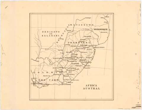
Africa Austral


Section: Maps, plans and nautical charts
Uniform title: AFRICA. SE. Mapas generales (189). 1:12300000
Title: Africa Austral
Material or type of resouce Area: Escala [ca. 1:12300000]
Publication: [189-?]
Physical description: 1 mapa : ms. ; 20,2 x 19,5 cm en h. de 25 x 32,6 cm
Content type: Imagen cartográfica
Media type: computadora
Carrier type: recurso en línea
Notes: Manuscrito a plumilla en tinta negra
Indica núcleos de población, carreteras y límites administrativos
UDC: 912(6-12)'1890/1899'
6-12
Type of publication:
 Maps
Maps
Rights:
Archivo Cartográfico de Estudios Geográficos del Centro Geográfico del Ejército
Collection: PCGE — Location: AR — Call number: Ar.Q-T.7-C.3-111 — Código de barras: 2214386
Préstamo:
 Disponible

© Ministerio de Defensa de España
P. de la Castellana, 109 28071 Madrid.
Tlf: (34) 91 395 50 00
Email: patrimonio.cultural@oc.mde.es