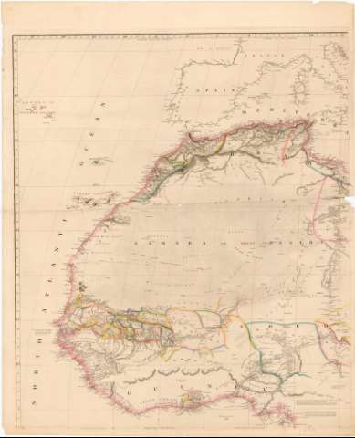
Map of Africa


Section: Maps, plans and nautical charts
Uniform title: AFRICA. Mapas generales (1841). 1:5300000
Title: Map of Africa / Constructed by A. Arrowsmith Hydrographer to Her Majesty
Material or type of resouce Area: [Ca. 1:5300000] ; [proyec. estereográfica ecuatorial] (O 35°-E 65°/N 45°-S 40°)
Publication: London : Published by Sam V. Arrowsmith, N 10 Soho Square, 1841
Physical description: 1 mapa en 4 h : col. ; h. de 101,2 x 83 cm ó menos, pleg. en 50 x 83 cm
Content type: Imagen cartográfica
Media type: computadora
Carrier type: recurso en línea
Notes: Escala hallada a partir de un grado de latitud [= 2,1 cm]. Red geográfica de 5° en 5°
Relieve representado por normales y sombreado
Indica itinerarios
Procede de la "Coleccion Coello"
Materia / lugar / evento: Mapas generales
Fronteras
Expediciones geográficas
Topónimos antiguos
Itinerarios
1841
Arabia
África
Other authors: Arrowsmith, Aaron, 1750-1823
Arrowsnith, Samuel, 0000-1839
UDC: 912:[341.222:910.4](6)'1841'
(53)
Type of publication:
 Maps
Maps
Rights:
Préstamo:
 Disponible
