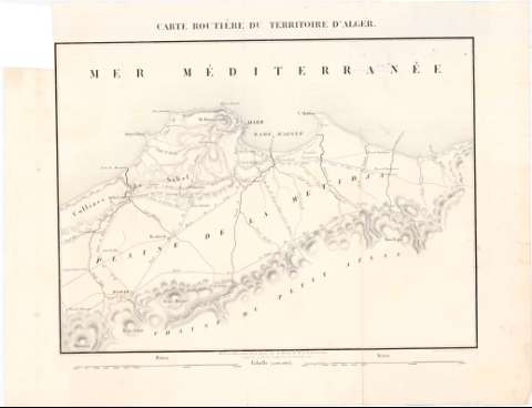
Carte routiére du territoire d'Alger


Section: Maps, plans and nautical charts
Uniform title: ARGEL (Argelia). Mapas generales (1855?). 1:200000
Title: Carte routiére du territoire d'Alger / Dessiné au Dépot général de la Guerre, sous la Direction de M'le Lt. General Pelet... ; gravé sur pierre par Alex. Zakrzewski
Material or type of resouce Area: 1:200000
Publication: Paris : Lith. de L. Letronne, Quai Voltaire 15, [1855?]
Physical description: 1 mapa ; 30,7 x 41,2 cm en h. de 39,8 x 52 cm
Content type: Imagen cartográfica
Media type: computadora
Carrier type: recurso en línea
Notes: Relieve representado por normales
Indica carreteras de primera, segunda y tercera clase
Materia / lugar / evento: Mapas generales
Carreteras
S.XIX
Argelia
Other authors: Pelet, Jean-Jacques-Germain, 1777-1858
Zakreski, Alexander, 1799-1866
Francia. Dépôt de la guerre
Lithographie de L. Letronne
UDC: 912:625.7(65-328 Argel)'1855'
65-328 Argel
Type of publication:
 Maps
Maps
Rights:
Préstamo:
 Disponible
