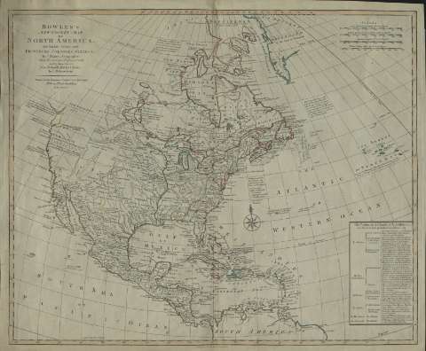
Bowle's New Pocket Map of North America : divided into...


 Maps, plans and nautical charts
Bowle's New Pocket Map of North America : divided into it's provinces, colonies, states (1784)
Maps, plans and nautical charts
Bowle's New Pocket Map of North America : divided into it's provinces, colonies, states (1784)
 Disponible Holdings
 Section: Maps, plans and nautical charts
Uniform title: América del Norte. Mapas políticos (1784). 1:1787993
Title: Bowle's New Pocket Map of North America : divided into it's provinces, colonies, states / by J. Palairet ; lately Revised and Improved with many additions from D'Anville, Mitchel and Bellin, by L. Delarochette
Material or type of resouce Area: [Ca. 1:1.787.993] ( (O 137°39'-O 32°39'/N 70°00'-N 0°00')
Publication: London : Carington Bowles, 1784
Physical description: 1 mapa : col. ; 46 x 57 cm
Content type: Imagen cartográfica
Media type: computadora
Carrier type: recurso en línea
Notes: Escalas lineales de 840 leguas geométricas, 280 leguas marinas, 245 leguas españolas y 1000 leguas inglesas [= 8,7 cm]. Coordenadas referidas al meridiano de Hierro. Orientado con rosa y lis
Leyenda explicativa con las posesiones de cada país
Materia / lugar / evento: Mapas políticos
América Central
América del Norte
Other authors: Palairet, Jean, 1697-1774
La Rochette, Louis Stanislas D'Arcy de
Bowles, Carrington, 1724-1793
UDC: (7)
Type of publication:
Maps
Rights:
Préstamo:
Disponible
