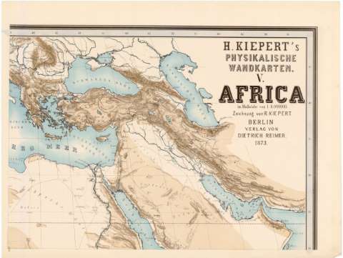
H. Kiepert's physikalische wandkarten V. Africa im...


 Maps, plans and nautical charts
H. Kiepert's physikalische wandkarten V. Africa im Masstabe von 1:8000000 (1873)
Maps, plans and nautical charts
H. Kiepert's physikalische wandkarten V. Africa im Masstabe von 1:8000000 (1873)
 Disponible Holdings
 Section: Maps, plans and nautical charts
Uniform title: AFRICA. Mapas físicos (1873). 1:800000
Title: H. Kiepert's physikalische wandkarten V. Africa im Masstabe von 1:8000000 / Zeichnung von R. Kiepert
Material or type of resouce Area: [Ca. 1:8000000] ; [proyec. ortográfica meridiana]
Publication: Berlin : Verlag von Dietrich Reimer, 1873
Physical description: 1 mapa en 6 h. : col. ; h. de 48,5 x 64,2 cm ó menos
Content type: Imagen cartográfica
Media type: computadora
Carrier type: recurso en línea
Notes: Presenta ademas un mapa político de Africa
Coordenadas referidas al meridiano de Hierro (O 15 -E 85/N 45 -S 35). Red geográfica de 5° en 5°
Relieve representado por sombreado
Other authors: Kiepert, Heinrich
Kiepert, R
Reimer, Dietrich
UDC: 912:911.2(6)'1873'
(4-13)
(53)
Type of publication:
Maps
Rights:
Préstamo:
Disponible
