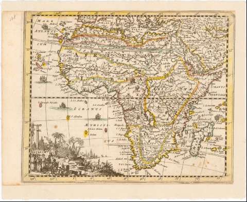
Africae


Section: Maps, plans and nautical charts
Uniform title: AFRICA. Mapas generales (16). 1:60000000
Title: Africae / Harrewyn F.
Material or type of resouce Area: [Ca. 1:60000000]
Publication: [Belgique? : [Editor no identificado], 16--?]
Physical description: 1 mapa : col., montado sobre tela ; 15 x 18,6 cm en h. de 17,5 x 21,5 cm
Content type: Imagen cartográfica
Media type: computadora
Carrier type: recurso en línea
Notes: Escala hallada a partir de un grado de latitud [= 2,1 cm]. Coordenadas referidas al meridiano de Hierro (E 348 -E 88/N 30 -S 30). Red geográfica de 10° en 10°
Relieve de perfil
Título enmarcado en cartela con escena costumbrista y paisaje
Other authors: Harrewijn, Jacobus, 1660-1727
UDC: 912:341.222(6)'17'
6
Type of publication:
 Maps
Maps
Rights:
Préstamo:
 Disponible
