Croquis de Piedrafita


Section: Maps, plans and nautical charts
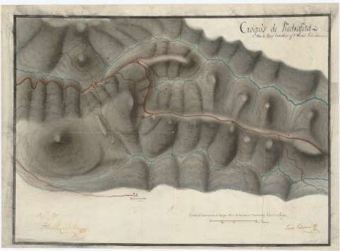
Title: Croquis de Piedrafita / Por D. Josef Castellar y D. Juan Echeverria
Material or type of resouce Area: Escala [ca. 1:22000]
Physical description: 1 mapa : ms., col., montado sobre tela ; 34,6 x 47,4 cm
Content type: Imagen cartográfica
Media type: computadora
Carrier type: recurso en línea
Notes: Comprende el puerto de Piedrafita del Cebrero, entre las provincias de Lugo y León
Firmado y rubricado por Juan Echevarría constando además, la firma de conformidad de José Castellar
Fecha tomada del catálogo del SGE: "Mapas de Galicia. Siglos XVII a XIX". 1695, p. 221
Escala gráfica de 200 varas de las que 8000 se andan en 75 minutos a paso de tropa [= 6,5 cm]
Orografía por curvas de configuración y sombreado
Destaca el trazado de la carretera que cruza el puerto
Iluminado en gris, azul, siena y carmin
Materia / lugar / evento: Mapas generales
Carreteras
Puertos de montaña
1812
Lugo (Provincia)
León (Provincia)
Castilla y León
Galicia
Other authors: Echevarría, Juan
Castellar, José de
UDC: 912:625.7(461.131.4)(462.111.6)"1812"
461.131.4 Piedrafita del Cebrero, Puerto
462.111.6 Piedrafita del Cebrero, Puerto
Type of publication:
 Maps
Maps
Rights:
Préstamo:
 Disponible
